
The bridge in Puenta la Reina has elegant lines.
Crossing the Arga: The Queen’s Medieval Marvel
We crossed the Arga on our way out of Puente la Reina—our final encounter with its waters.
I leaned over the stone rail, my sunglasses dangling from a cord around my neck. The flow beneath us, like our own journey, had tumbled off the Pyrenees. But while we walked west, the river unspools south, eventually merging with the Ebro—the Ibēr of the Greeks and Romans.* From there, it flattens into one of the largest wetlands in the Western Mediterranean, blossoming into a delta halfway between Barcelona and Valencia. It’s 200 miles away as the bird flies.
My eyes drifted with the current: I’d like to see that delta one day. I hear the birding is terrific.**

The view across the bridge from the gatehouse (left) and a view to one of the footings (right).
The masonry bridge over the Arga is a medieval marvel. It has withstood the current for more than a thousand years. Massive footings support six arches that provide a passageway that is 110 meters long. “Windows” between the primary arches lighten the structure and allow water to pass through in flood season.
Those who study such things dub it “romanesque,” for reasons of style and origin. Romanesque structures are distinctly medieval and European. They feature circles and arches and emphasize strength and symmetry.
This structure gave the town its name: Puente la Reina, “The Bridge of the Queen.” Construction was sponsored in the 11th century by Muniadona, wife of King Sancho III. As a convergence point on the Camino Francés, the bridge likely served as a convenient bottleneck for collecting a pontazgo, or bridge toll. Bob and I—like so many pilgrims before us—crossed and continued west.

There are four major routes or "streams" across France that feed the Camino de Santiago. Recognize that the site labeled here as Compostela is the same as Santiago de Compostela or simply Santiago. Image from here, accessed 6/27/2018.
Golden Fields and Templar Shadows
Despite a wretched hotel experience the night before, the morning was glorious. The grain fields were soft and golden in the early light.
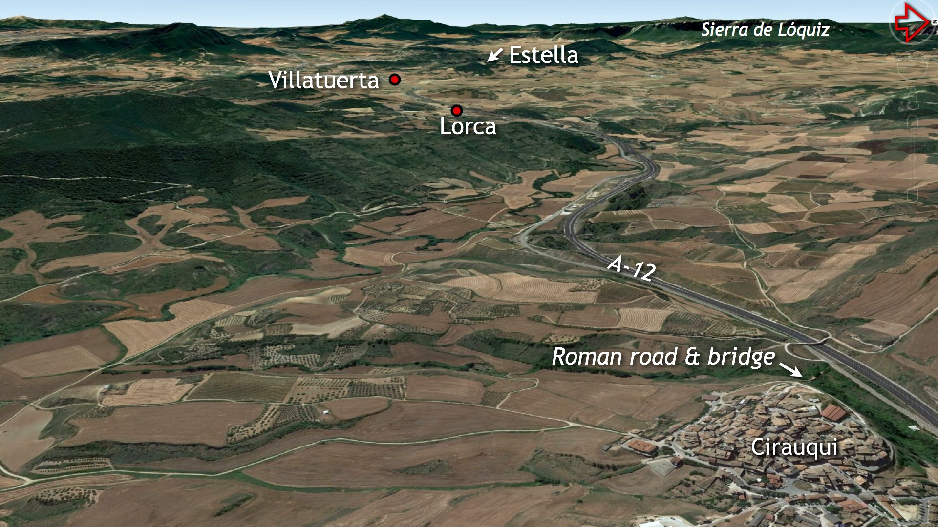
We passed through picturesque villages: Mañeru, Cirauqui, and Lorca. The influence of the Knights Templars was felt in each. But before the Templars, there were Romans. Finding the remains of their efforts at Cirauqui was my priority.

The village of Cirauqui is draped over a knob.
Walking with Romans: The Ancient Pavers of Cirauqui
Outside Cirauqui, the trail led us onto the remains of a Roman road.
Tik, tik, tik. Our walking sticks struck pavers that may have been laid in the 2nd century AD. Large kerbstones formed the margins, while smaller pavers locked the surface together. Such ancient exposures are rare; because Roman engineers chose the best routes, their roads were usually overbuilt by later generations.

The Roman road outside Cirauqui.
The road descended the hill to a single-arched bridge even older than the one at Puente la Reina. Though heavily renovated, one face of the original structure remained visible through the brush. We marveled, snapped a few photos, and pressed on toward Estella.

This image of the bridge at Cirauqui was taken when the brush was less challenging. Stone colors, textures and lines make it clear that the bridge has seen several phases of repair. This photograph was found here (accessed 10/21/2021).
The Fluttering Ribbon: The Cliffs of Sierra de Lóquiz
On the horizon, the white cliffs of the Sierra de Lóquiz appeared like a fluttering ribbon in the sun. I later learned this karstic feature stretches 13 miles with cliffs rising a thousand feet, but to us, it was a distant, captivating landmark.
We never got close to this fluttering ribbon, but it sure captured our attention.

The white cliffs of the Sierra de Lóquiz defined our horizon.
Arrival in Estella: A Communal End to a Glorious Day
At last, we cruised into Estella and found a 22-bunk hostel operated by the Church of San Miguel. It was a lovely place. We spent the evening on a courtyard park bench, sharing a simple meal of salad, tuna, and boiled eggs with four French travelers.
¡Buen Camino!
*From the Ibēr (Ἴβηρ) springs the name Iberus or Iberian. The name is attached to the whole of modern Spain and Portugal, hence “Iberia” or the “Iberian Peninsula.” Some debate revolves around the question of whether the river gave its name to the residents or the residents gave their name to the people. See the article here (accessed 10/20/2021). Note also how Pliny the Elder (Natural History 3.3) views the Ebro as the centerline of the region.
**The Parque Natural del Delta del Ebro is one of the premier bird watching sites in all of Europe. It is home to many overwintering species and serves as a stopover for many migratory fowl. See the article here (accessed 10/19/2021).

The donativo is another type of lodging along the Camino. These are typically owned by the local diocese and are funded by gracious travelers. A donation box like this one is a place of payment.
With travel restrictions easing, we have a full slate of trips to the Bible Lands ready to launch in 2022. One departs New York for Israel on March 12 and returns on March 25. This high-energy study tour will move light and fast, so pack your hiking shoes! Walt Harper, professor from Central Christian College of the Bible and Jeff Snell from Johnson University will assist with teaching duties on this one. For more information click here or contact me at markziese@gmail.com.
